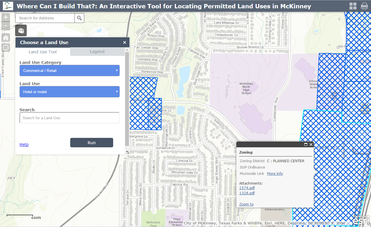
The City of McKinney recently launched a new interactive online mapping too. The tool named ‘“Where Can I Build That?” provides quick access to information about allowed land uses and other zoning entitlements in McKinney.

Residents, developers, and interested stakeholders can use this web application to get a snapshot of where specific land uses are allowed in McKinney based on a property’s current zoning district designation. The City hopes this tool will provide a more efficient process for identifying land use entitlements and should decrease the time needed to answer basic questions about where certain land uses are permitted in the city.
Michael Quint is Mckinney’s Executive Director of Development Services.
Link: http://maps2.mckinneytexas.org/Land%20Use%20Locator/
- NRP Group to build the 330-unit Harvard Flats in Princeton - March 28, 2024
- The Home Depot Announces Agreement to Acquire McKinney Texas based SRS Distribution - March 28, 2024
- City of Celina Unveils Exciting Schedule for Friday Night Markets - February 27, 2024